|


| |
SonarVista
SonarMite data processing software

SonarVista Data Processing Software
For most small boat applications the SonarVista software provides a complete
solution that lets the user combine Depth, Position and Tide data to produce a
processed final survey data set. The software package is normally provided with
the SonarMite echo sounder or the
TidaLite tide gauge instruments as the download,
editing and processing software. The program is designed for use on PCs running
the Windows XP or Vista operating systems.
SonarVista software enables the user to download directly from the
instrument processor the stored data. On fetching the
data, the program checks the time difference between the two processors to
within 10ms, data can be time adjusted to bring the downloaded data into the
same temporal frame as the position data already stored on the computer. In
addition to downloading data the SonarVista software can import position, depth and
tide gauge data in a variety of different file formats. All data brought into
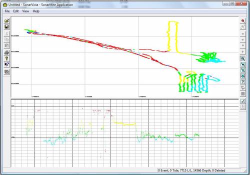
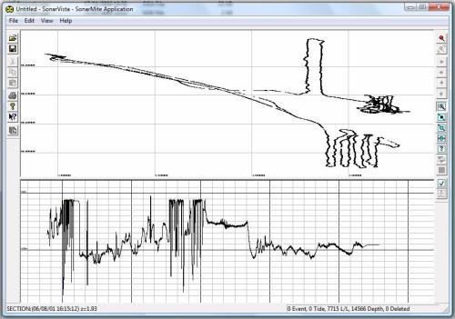
the program is sorted by time and visually presented as a time series long
section together with a plan view.


Section & Plan View of a Survey- showing colour options
Once the data is all present within the program the software can be
used to edit the data, remove spikes and apply dimensional and temporal
offsets independently to any of the main data elements of tide, depth and
position. The software then interpolates intermediate values such as tide
and position for depths, tide and depth for positions etc. When complete
the user can export the processed data to a wide variety of datafile
formats including ASCII, CSV, XYZ and 3D DXF for import to CAD packages.

Main Features
 | Instrument Data Import |
|
Binary data import from SonarMite and TidaLite instruments
|
 | Windows Compliant |
|
Tested on Windows XP, TabletPC, Vista
|
 | Graphical Editing |
|
Interactive editing of plan or time series data using
graphic windows, toolbar commands and drag/drop techniques
|
 | External Data Import |
|
Import Tide Gauge, Position and Depth data from a wide
variety of formats including NMEA, ASCII, Leica and Trimble GPS
|
 | Data Export |
|
Export data to industry standard file formats including
NMEA, ASCII, XYZ, Geotronics, Excel CSV, AutoCAD 3D DXF,
Google Earth KML |
 | On-Line Help |
|
The software uses the latest contextual help methods to
provide on-line information about program functions. An extensive help
file is provided with details of methods employed and example data sets |


|


![]()